How Drones Are Changing Topographic Data Collection
January 8, 2026
The Gilbert-Chandler Area Drainage Master Study/Plan (ADMS/P) Update is being updated using multiple data sources, including topographic information. This data helps the project team understand the study area’s physical features, from natural elements such as hills, slopes, and washes to man-made features like roads, graded subdivisions, agricultural fields, and constructed drainage channels.
Topography can affect how and where stormwater flows. For instance, stormwater runoff flows faster and is more concentrated on paved streets than across agricultural fields. With the study area’s expanded growth over the last several years, having recent and accurate topographic data is important in developing a better depiction of flood hazards.
One way the project team is collecting topographic data is using drones. This fall, drones—small, pilotless aircraft—were deployed to gather updated data across multiple areas within the study area. These smaller, targeted sites, ranging from about one to 70 acres, have experienced development changes since the original topographic data was collected in 2021.
Drone Imagery
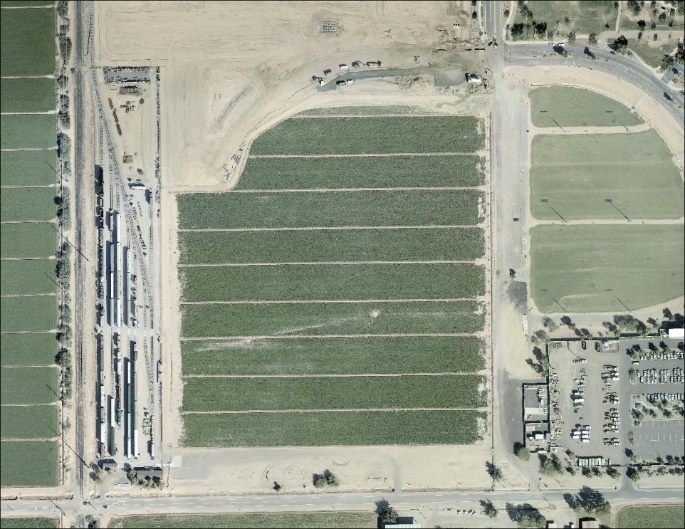
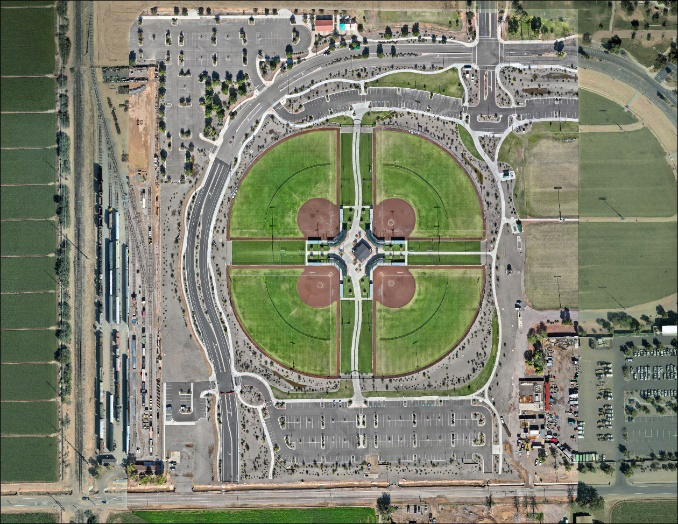
As an example, the images below show the original aerial imagery with the latest data collected this fall. Since 2021, this site has been transformed to Tumbleweed Park at Ryan Road and Pioneer Parkway in Chandler.
Pros of Drone Use
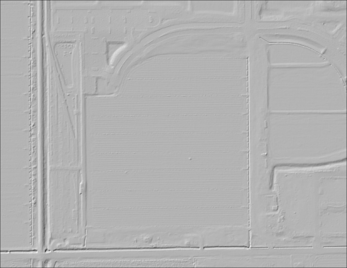
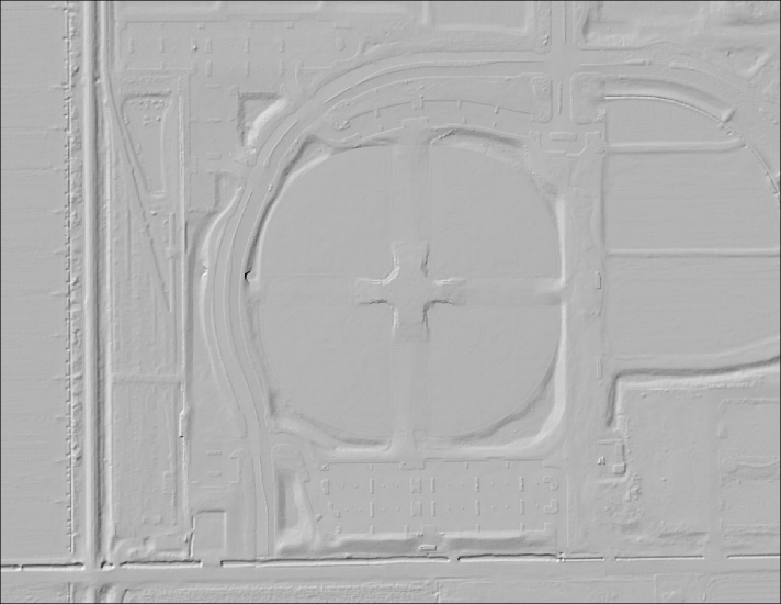
Collecting data with drones offers several advantages, including efficiency, cost-effectiveness, and versatility—particularly for smaller areas compared to using airplanes to collect LiDAR (Light Detection and Ranging) data. The second set of images illustrates the before-and-after topographic data for the same site. The ‘Before’ image shows data from 2021, while the ‘Current’ image reflects drone-collected data, clearly showing the ballpark and surrounding grading.
Collecting the Data
While drones offer many benefits, their use can present challenges such as access restrictions near airports and critical infrastructure. Careful planning and coordination are essential, as the team complies with Federal Aviation Administration (FAA) requirements and secures approval for all flights. Every drone pilot is FAA licensed and certified, and weather conditions are assessed before each mission to ensure safety.
To maintain data accuracy, quality checks are performed both during the flight and after data collection. Once gathered, the data is analyzed and integrated into existing topographic data.
This updated topographic information is one of several data sources feeding into the detailed Hydrology and Hydraulic (H&H) Modeling being developed as part of the project’s second phase.
Visit our Interactive Map Activity
and add a marker to indicate locations where flooding has occurred or share areas you believe could be at risk in the future.
Read the February 2025 Blog
to learn more about the data sources used in the G-C ADMS/P Update and the process for documenting storm events.
Gathering public information about storm events is essential for pinpointing flood locations and helping the study team validate and confirm modeling results.


