This information will be used in Phase IV to help develop solutions that reduce flooding.
By understanding community plans and goals, we can find opportunities and limits for future projects.
April 29, 2026
As Phase II of the Gilbert-Chandler Area Drainage Master Study/Plan (ADMS/P) Update continues, our team is collecting more information about the area.
In past updates, we’ve talked about the data used to build our Hydrology and Hydraulic (H&H) model. This model helps show where flooding happens today. You can read our February 2025 blog to learn more about that work.
Today, we’re focusing on another important type of information: Non-H&H data.
Non-H&H data includes things like land use plans, parks, transportation, water use, and climate trends.
We are bringing this information together into one place. This helps us understand how the area is planned today and how it may grow in the future.
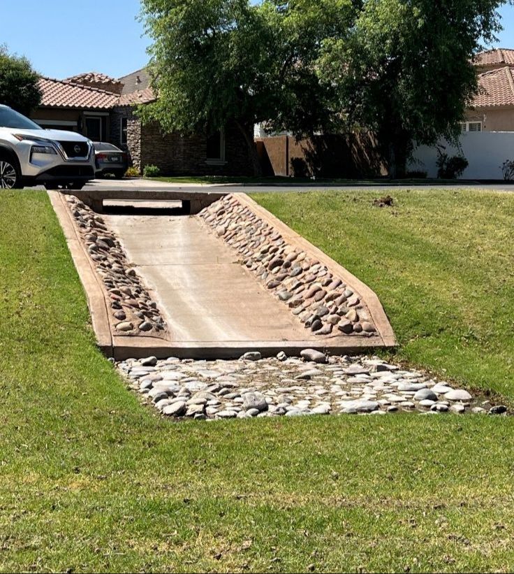
Some parks do more than provide space to play. For example, Freestone Park in Gilbert and Arrowhead Meadows Park in Chandler can also collect and hold stormwater during heavy rain. Many neighborhood parks and fields do the same thing. These spaces help reduce flooding and can even help refill groundwater.
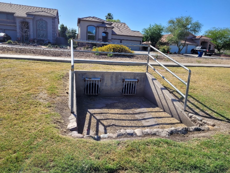
When stormwater soaks into the ground, it helps refill underground water supplies. In Chandler, thousands of drywells and large retention basins make this possible. Each year, this system helps store a large amount of water underground.
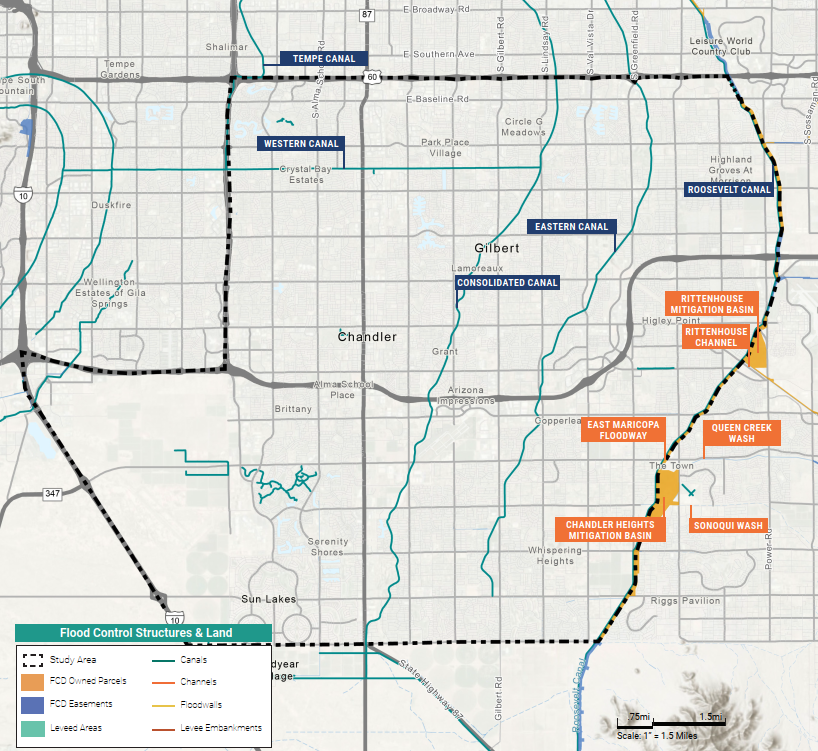
Chandler and Gilbert feature several flood control structures, including the Tempe and Western canals, Rittenhouse Channel and Queen Creek Wash. Canals and flood control basins play significant roles in resource conservation.
Plans like the Maricopa County Natural Resource Master Plan focus on protecting and improving natural spaces. This includes actions like managing invasive species, supporting wildlife, and using rainwater to help the environment.
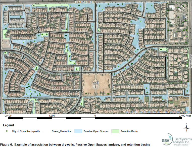
The City of Chandler is home to several drywells, passive open spaces and retention basins. This map illustrates how prominent water management infrastructure is across Chandler neighborhoods.
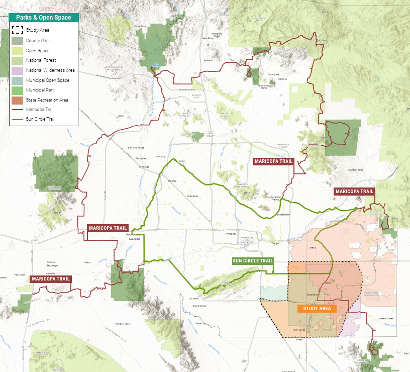
We also look at how parks, open spaces, and waterways connect across the region. These connections support both people and wildlife and help guide future planning.
Other important parts of Non-H&H data include green infrastructure, low-impact development, and conserving resources. These approaches support sustainable growth, improve access to parks, and help reduce heat.
A primary goal of Chandler’s general plan outlines a vision for an interconnected park system that leverages trails, open spaces and greenways. The importance of preserving natural areas and integrating them with recreational spaces is a recurring theme.
This information will be used in Phase IV to help develop solutions that reduce flooding.
By understanding community plans and goals, we can find opportunities and limits for future projects.
We also map this information across the study area. This helps show where different ideas and solutions may work best.
By combining technical data with planning information, we can support better decisions about flooding, water use, and community resilience.
![]()
Have questions, want to learn more about the project, or request a presentation from the study team, contact us below:
| Name | Obenia Kingsby II, Project Manager, Flood Control District of Maricopa County |
|---|---|
| Phone | 602-506-5469 |
| obenia.kingsbyii@maricopa.gov | |
| Website | www.maricopa.gov/5308/Flood-Control-District |
Sign up for information and updates.


